BootsnAll Travel Network


Archive for November, 2008

« Home

Heli-hike on Franz Josef glacier

Friday, November 28th, 2008

Heli-hike on the Franz Josef glacier. I can’t really describe it that well so I’ll type a little bit and posts lots of pics…

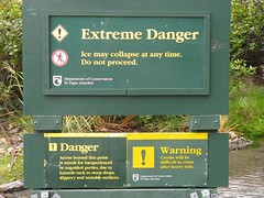
There are various different options for hiking on the glacier, most of them involve hiking to the base of the glacier which we did for free unguided. The alternative was the heli-hike. Helicopter ride to high up on the glacier, then hiking around on it for a couple hours before another helicopter takes you back down to town.

helicopter

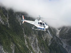
I’ve never been on a helicopter before so that was cool in and of itself, plus you are flying over a glacier. The weather was perfect.

view from helicopter

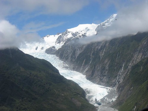
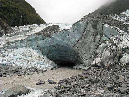
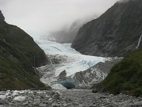
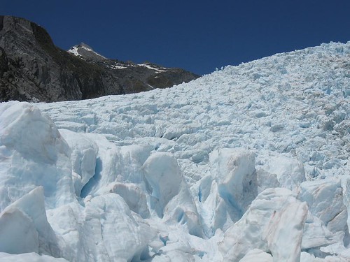
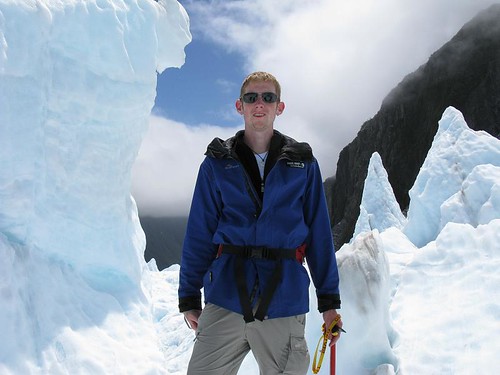
Once on the glacier, you get ice picks/axes and crampons and start hiking. Some parts were steep, some pretty flat. Some areas had huge towering chunks of ice, and there were a few ice caves and tunnels we went through. The ice formations are all unique, it’s different every 20ft you walk and the colour blue in parts of the glacier is stunning. Awesome hike. Here’s some pics…
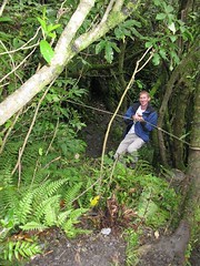
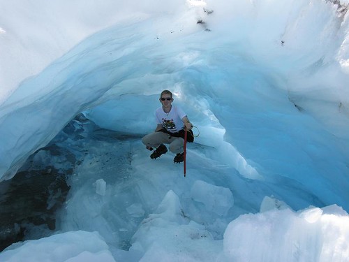
me in an ice cave:
me entering a blue ice cave

the glacier

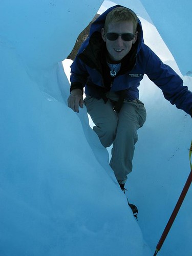
me in another ice cave:
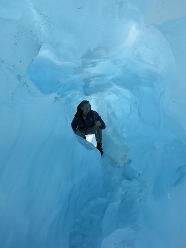
me in an ice cave

stream on the glacier
me on the glacier

Another Ice cave:

me inside an ice cave

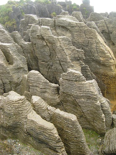
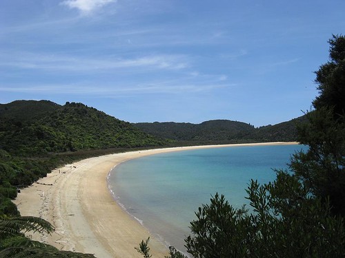
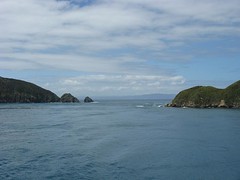
After that, we drove down the coast…

West coast lookout point

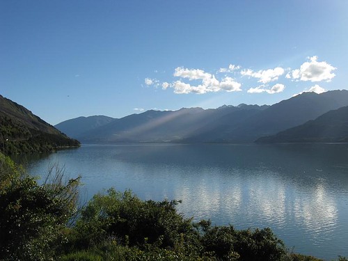
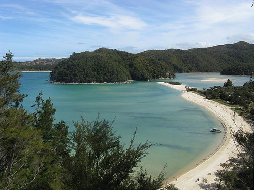
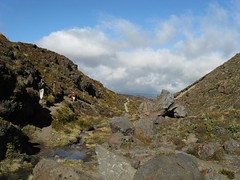
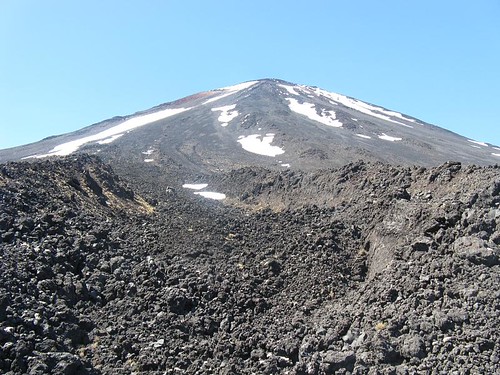
and across the mountains to Wanaka. Not bad scenery around here either…

near haast pass

Franz Josef glacier

Wednesday, November 26th, 2008

Well after sitting at the hostel for a 2 full days waiting out the downpour here it finally cleared up over lastnight.  We took full advantage of that, went out to the coast in the morning and then hiked up to the glacier in the afternoon.

ice cave, river exiting the glacier

The hike to the glacier was partially on a “trail” through rainforest and partially just going through the rock fields below the glacier along the river.  Some parts where there was an actual trail to follow it looked like a small trail, other parts we actual streams we were walking through or even more fun, waterfalls (some with water running, other not), some of the waterfalls had ropes to help you get up and down due to the insane level of steepness and slipperyness.  We started calling it the Ho Chi Minh trail at that point… 

me hiking through rainforest

Quite a few largish streams had to be forded along the way too, mainly because of the sustained rain the last few days.  My next pair of hiking shoes will be waterproof, for sure.

me crossing a stream

We kept passing danger signs, each one more serious sounding than the last.  Claiming it was not recommended to hike past certain points without an experienced hiker or guide.  While I realize there are levels of risk to the trail (most of which I think would be climbing on and around the actual glacier which we didn’t do), part of me can’t help but think that all the “glacier hiking” companies what want people to pay $150 for a half day hike up to and on the glacier have something to do with there being so many signs saying it’s not recommended.  Especially since the start of this trail is a tiny offshoot of the main short trail to a lookout point which is all most people do and there’s no sign at all there, not even one telling you it’s a trail.  I enjoyed passing the danger signs at any rate + going at a much faster pace than the hiking tours that we passed along the way.

the last danger sign we passed

The glacier looks more awesome and amazing the closer you get, it really is a sight to see, a massive river of twisted and crevice filled ice wedged in between 2 mountains. 

the glacier

Watching the milky grey water (full of superfine powdered rock crushed by the glacier) flow out from the base of the glacier is really cool. 

river

All in all it was 6 miles round trip and well worth the excursion, and drinking from the glacier was cool…

kissing the glacier

With the weather set to improve even more we have a helicopter ride up to the top of the glacier tomorrow, and hiking around on it.

the West Coast, and the rain comes down…

Tuesday, November 25th, 2008

Leaving the Abel Tasman park and heading South West through the mountains to the coast, via windy roads through heavy rain and over many one lane bridges which seem to be a popular occurrence here.  The ones that are also the railway bridges are fun to cross.


Spent one night at a hostel called Noahs Ark, appropriate with the weather there, and then continued down the coast, stopping to see the pancake rocks along the way to the Franz Joseph glacier.


IMG_2177

Now we are waiting out the rain storm in the town below the glacier (that I haven’t seen yet), killing time, drinking some wine etc… Right now it has basically been raining heavily nonstop for almost 2 days with high winds too, the power was flickering on and off this evening. I’ve never seen such sustained heavy rain before! We have decided to wait out the weather which is supposed to clear so we can hike on the glacier before moving on.  

Abel Tasman Park

Sunday, November 23rd, 2008

Got up at 7 in the morning in order to get checked out of the hostel and up the the launching point for our water taxi.  We decided to get the water taxi up along the coastline of the Abel Tasman park, hike back part way and then catch the water taxi back to the park entrance.

The weather could not have been better.  First the taxi takes us up the coast past numerous insanely idyllic beaches and coves, including a small seal colony on an offshore island.  Then, we get off on one of the most perfect beaches/coves I’ve ever seen.

torrent bay

The hike back down the coastline was mostly through bushland and some forest, every now and then turning a corner there was a stunning overview of a different cove.  Our halfway point on the trail was barks bay, which is similarly perfect to the start of the hike, just unique in it’s own way.  The crescent shaped smooth sandy beach here goes out far into the bay sloping down very slowly underwater.  It was so perfect I had to go for a swim and the water and view were amazing.

barks bay

me swimming @ barks bay

A truly great day, I can’t think of a way it could’ve been much better, was rounded off by getting a cheese fix for dinner and the a bottle of the local, world famous, sauvignon blanc wine.  The best thing about the day was, I didn’t just see cool beaches, I saw a collection of the best coves and beaches I’ve ever seen, in perfect weather, and for the most part hardly anyone was on any of them.

tonga bay beach

Wellington

Sunday, November 23rd, 2008

After the Tongariro crossing, we headed down to Wellington via Napier, a town in the centre of the hawkes bay wine region with classic art deco buildings in it and not a whole lot else.  Wellington lives up to the reputation of being windy, very windy.  The town is crammed in between the coastline and the hills surrounding it, some of the hills there felt like San Francisco.  Wellington is full of great eateries and watering holes, a very good night out, I was amazed how many people were out late on a Wed night.  I had the first kiwi beer that I actually really liked here and relived some of my asian experiences at great Japanese and Korean places in town.

eating Korean, bibimbap & kimchi!

Wellington is the departure point for the ferries to the South island, to Picton.  It’s a 3 hours ferry ride, some of which has some pretty cool views.  Picton is small, with not a whole lot of anything there, strange considering it is the entry point into the South island for anyone who takes a ferry across the Cook straight.

view from the interislander ferry

After disembarking from the ferry we drove from Picton to Nelson along the coast on a very scenic and winding road through the hills.  Nelson is somewhat of a yuppie town, we just spent the night there en route to the Abel Tasman park.

Tongariro Alpine Crossing

Sunday, November 16th, 2008

The Tongariro Alpine crossing is meant to be the best one day hike in New Zealand, 18km’s in between two volcanos, through numerous radically diverse regions.  We hiked that today, weather was just about perfect for it with the only issue being cloud cover descending from the pass which is hardly unusual.  Mountains like this have a funny way of making their own clouds and weather patterns anyway…

Tongariro Park has 3 main peaks in it, 2 of which are active volcanos (one was used as Mt Doom in filming for the LOTR trilogy).  This hike doesn’t take you by that volcano, (though parts of it felt like I was walking in the movie) but between the other active volcano in the park “Mt Ngauruhoe” and the other main peak “Mt Tongariro”.  Fantastic hike, the scenery was amazing and it wasn’t that hard, I feel fine tonight…

I’m going to post quite a few of the different parts of the trail on here, thee diversity was stunning.  From alpine tundra, to plantless lava fields and much more…

These are a very small sampling of what I put on flickr.

First section of the hike:

hiking into the lava fields

Up the lava fields:
view from the lava fields

Large crater:

main crater

Around the pass:

emerald lakes

Alpine Tundra:

alpine tundra

Grasslands:

grasslands

Skydive in Taupo

Saturday, November 15th, 2008

Left Rotorua this morning, down to lake Taupo the skydiving capital of New Zealand and I thought it’d be silly not to find out for myself why that is…

Once I was suited up and got on the plane, the whole experience was about 20-25 minutes until I was back on the ground via the less conventional method. The jump was from 12000ft with perfectly sunny skies by the lake. It’s a tandem skydive so I had a guy strapped on to me operating the parachute etc, all I had to do was enjoy it all.

IMG_0100

Up to 12000ft and the green light goes on inside the aircraft, my tandem partner opens the door and I sit on the edge of the plane with my legs dangling underneath it as instructed. The view looking down from out of an airplane is quite different than looking out the windows, especially when you are jumping out of the plane. The first few seconds out of the plane you spin around and until you are in the stabilized free fall, those few seconds are unlike anything else.

The free fall lasts for about 45 seconds when jumping from this height, traveling around 200km/hr, though aside from the wind battering your face it doesn’t feel like you’re moving that fast, after you initially get out of the plane anyway. The first few seconds you feel the speed… Free fall is an awesome sensation, albeit a short one. Followed by the chute opening and gliding around slowly for several more minutes, also great fun and the whole time with a fantastic view before landing back where the plane took off from.

IMG_0123

I thoroughly enjoyed the entire thing, absolutely fantastic!

IMG_0124

IMG_0126

Didn’t convince my Uncle to do the jump, maybe next time ;-)
Tomorrow we’re hiking around a couple volcanos….

Northland

Saturday, November 15th, 2008

Well I got my computer back (fixed, yay!) yesterday so I can upload pictures and post on here much easier again.  This entry is a summary of that last few days.

I left the Bay of Islands and drove North, just about as far North as you can drive without ending up in the Pacific Ocean, Cape Reinga.  Not particularly fascinating, but it is pretty cool watching the Pacific Ocean and the Tasman Sea crashing into each other.  I’ve never seen anything like that. Along the way up to the cape I stopped at 90 mile beach (which while quite long, isn’t anywhere near 90 miles long) and the Te Paki sand dunes which are immense, stretching inland a very long way.  By far the biggest and coolest sand dunes I’ve ever seen.

IMG_1302

Next day I headed back down South, this time on the West coast, ending up around the Hokianga bay.  I went to the ancient Kauri (tree) forest.  Pretty big trees, if I hadn’t been to California and seen the Redwoods and Sequoias (which are both more impressive) in September I may have been more in awe.  Even so the forest is a very different atmosphere with tons of really tall fern trees everywhere.

me and one of the kauris

I rounded the day off in grand fashion by sitting in a hammock and watching the sun set over the Tasman across the bay.  Pretty spectacular colours…

sunset over the bay

Continued heading South the next morning, and back across country to the East coast.  Ending up in Mangawhai Heads, my last stop before going through Auckland to pick up my Uncle and continuing on Southwards.  I started out on the costal cliff walk by the Mangawhai Heads surf beach but I didn’t get that far since the return was impossible at high tide which was fast approaching.  It’s awesome coastline along here though even the small part I saw.

After driving through Auckland, picking up my Uncle and being reunited with my laptop we headed South to Rotorua.  The thermal hotspot of New Zealand, complete with boiling mud pots, geysers and plenty of sulfur.  The town of Rotorua itself isn’t anything special, mainly just catering to all the tourists they get here.  We just went to one of the thermal parks around here.  I’ve seen thermal features before but never such vivid colourings in the pools.  Stunning colours here and the perfect weather here helped bring them out.

All of this Southerly travel is bringing me closer and closer to Mt Doom.  I really need to get rid of that ring… ;-)

Bay Of Islands

Sunday, November 9th, 2008

Left Auckland after dropping my computer off for repairs, picking up my rental car and drove up to the bay of islands.  Beautiful sunny day up there, nice change from Auckland.

First day here I rode a bike up to a lookout point for a view of the inner bay, and then spent the afternoon kayaking across the bay and up a mangrove lined river.  Pretty good fun but lots of working kayaking back against the wind.

Second day here, I took a day trip on a 45ft sailing boat out around the bay.  Captained by a Canadian expat it was only me and a couple other English people on the trip.  Fantastic day, and the capt was great.  He had us steering the boat, adjusting the sails and doing just about everything.  After a couple hours sailing we stopped at an island, the first place Capt Cook landed on oh so long ago and explored it for a while, swam in the bay there off the beach.  The waters not that cold here… Then we sailed back into the port.  Really nice day, this is a really nice bay, the islands just keep on going out to sea.  We just about got to the end of them in a couple hours of sailing…

IMG_1238

My day tomorrow when I leave the bay of island will depend on the weather.

New Zealand

Thursday, November 6th, 2008

Right now it’s my last night in Auckland, I’m getting my rental car in the morning and heading North.  I’ve been at a good hostel here, met quite a few people and gotten lots of ideas of stuff to do in New Zealand.  Today I also received a free guitar from someone here at the hostel, good stuff!

Since my last blog entry, I have explored the Auckland museum including a traditional Maori performance there.  I’ve walked over the majority of Auckland city numerous times, eaten some good food including the best fish and chips I’ve had in a long time today in Devonport, across the bay from Auckland.  I’m pretty eager to get out of Auckland tomorrow and start exploring New Zealand though.  Nothing wrong with Auckland, just isn’t great like most of what there is to do in New Zealand.  Or so I hear…

Everything here is so much easier to do than in Asia, travel in English speaking countries is a doddle!  I can actually use the phone without any trouble!  Most of the time I spend “traveling” is speant reading the guidebook or making decisions about where to go instead of trying to figure out schedules and notices in foreign languages.  Much more space here, the air is better too.  I also noticed the greenery in Auckland, a big contrast to most places in Asia where there is so much less green.  I did expect all of this, I went from one of the hardest places to travel as an English speaker, to one of the easiest, according to many people here New Zealand is the easiest country to backpack around.  I don’t doubt it so far.

I have all sorts of ideas for my stay here now, including many kinds of outdoor activities.  Hopefully starting in the Bay of Islands, my next stop.