OFF THE BEAT IN BACH MA
Thursday, February 22nd, 2007BACH MA NATIONAL PARK
I have put some details on visiting the park in this blog that may bore regular visitors to my blog, but that will hopefully help future visitors, as I could not find much on the web outside the official park web site. National Parks in Vietnam are kind of a new concept to the quickly developing country and consequently getting to them for a visit is still a challenge. However, we decided that we couldn’t miss seeing some of the wild side of Vietnam, and Bach Ma isnear the central coast and is fairly accessible and possible to visit without a guided tour group. (which make me break out in cold sweats being out of control of my travel destiny….!)

HUCK FINN REACHES THE SUMMIT OF BACH MA
So we arranged a car drop off from Hue, and decided to spend two days and a night in a guesthouse near the summit of Bach Ma NP The park is quite large and extends dramatically up from the bays and ocean below, making for a quick change in scenery as you climb up the mountain (in a National Park van). As you climb you can also feel the climate change a number of times, with the summit area jungle being more temperate than the coastal lowlands. Although we were warned it could be cold at the top, it really never was chilly at all, even at dawn in the guesthouse, which does provide 2 blankets/bed. The hiking was still pretty hot, but certainly better than the flatlands, as you could actually hike in the middle of the day without collapsing. Of course, the Vietnamese working in the park wore jackets which still astounds me, as they clearly have a completely different adaptation for temperature. We humans are similar, but still very different in many ways. When visiting the various French and American war sites and museums here, I am now struck by the fact that the locals had a huge advantage in stamina and exhaustion over some Polish-American 18 year-old from Milwaukee, but I diverge again from the focus of this post. (step back, settle down, and focus)
The reward for getting off the tourist path was that we virtually had the trails and summit to ourselves midweek, with just a few day trippers and 2 young and intrepid Kiwi women. I think they hiked the 12 miles down the mountain to the main road at 5 am with their full packs as we heard them get up and go!!. They were younger though… It was a nice peaceful break from the Vietnamese cities and I tried to breathe in as much fresh air and scent as possible. There are two big draws to Bach Ma National Park: birds and waterfalls, although the former are mostly well hidden, so you end up hearing a cacophony of jungle birds, but rarely see anything, unless you are a very patient birder with a good set of binocs. There are something like 250 bird species in BMNP which makes it one of the most diverse ecosystems in Asia.
WHEN TO VISIT? The waterfalls and cascade pools are impressive and beautiful and we apparently hit the park at one of the best times of the year. September to November is the HEAVY, HEAVY rain season, with leaches being a big problem into January. February and March are cooler and the waterfalls are still going strong after the long rains. By April the waterfalls diminish. We visited midweek and only two rooms were occupied at the older park lodge. We understand that they get loads of Vietnamese visitors on the weekends and later in the year (when its not so cold?!) and there is a huge set of speakers and Karaoke machine in the main lodges restaurant area which are aimed right at the stone and concrete buiding across the street that we slept in. I would avoid weekends if you want a peaceful visit.
THE TRAILS. The website gives a pretty good summary of the trails. One of the more amazing waterfalls that I have seen in my life is Rhododendron Falls, which drops of a rocky precipice into a vast and lush green valley over 1000 feet below. It is totally worth hiking to this beauty and proceeding down the 689 steps to the view area at the bottom of the falls, especially when the river flows are strong. It is the highlight of the park. (By the way, we saw virtually no Roddes anywhere, but is was supposed to be the season?)

WHERE IS EVERYONE – AT THE BASE OF RHODODENDRON FALLS
As Cheryl was feeling a bit under the weather, I hiked down alone to the falls at a steady and determined pace in about 20 minutes and back in about 25, but the stairs are steep, irregular, and slope downward a bit, making the trip down a little challenging. The trail is overgrown near the top of the trail, but then opens up once you get past the first 100 stairs so don’t be discouraged.

Look for a walking stick in the woods above the falls and leave it when you get back to the top, as it will save your knees. You can crawl down onto the rocks below the main falls and get great perspectives up into the cascading whiteness. I saw no one and on this hike and had the falls to myself, which always makes a natural experience more spiritual. This would be mobbed with tour buses if access was easy.
Connector Trail: Although there is a spur down to the falls, there are two ways to access the spur trail: from either the main trail head a kilometer or so down the road from the NP guesthouse (look for building at view spot and trail is on left) or from a the connecting trail from the Five Lakes Trail. The connecting trail from Five Lakes to the Rhododendron is one of the parks nicest as it crosses some streams and stays relatively level through the forest for about 2 kilometers.

Amazing Cascades Along the Five Lakes Trail
The Five Lakes trail: You can access this trail 3-ways. The most direct route is from behind the main NP guesthouse: go down the hill, concrete road/path and stairs towards the abandoned/under construction(?) building down on the next terrace and stay left until you hit the top of a long set of stone/concrete stairs. These stairs and trail lead to a T junction which if you turn right takes you to the Five Lakes, while left takes you back up to the summit road, about 1 1/2 km above the NP Guesthouse (or on the right side of the road about 100 yards BEFORE the water treatment building) but this stretch of trail is pretty dull and was overgrown when we took it down to Five Lakes. The NP brochure “map” does not show the access to Five Lakes downhill from behind the Guesthouse lodge. And when you turn right from the T junction, you will soon come to this confusing sign….

Trail Split on the Five Lakes Trail
What it means is this: Left takes you to the first cascade and pools (Lake No. 1) and from there you can follow a series of ladders, cables, and contortions to work your way down the creek to Lake Five. We only followed this route to Lake No. 2 as the trail seemed to disappear or get ridiculous at this point. All these cascades and lakes are beautiful. If you turn right at the junction, you climb briefly up and over a little ridge and then down to the large Lake No. Five, which is very beautiful. This way is also the easy way to get to the connector trail as it breaks off right prior to Lake No. 5.
Summit Trail and Nature Exploration Trail. You can make a nice loop by taking the Nature Exploration trail up and then meandering down from the summit on the paved road. (with no traffic). To start the loop, head up the road from the NP Guesthouse and then take the stone stairs to the left at the signed Orchid house. The trail heads immediately up steep stairs through the woods from the left side of the Orchid House. After climbing many steep stairs, the trail levels out for a few kilometers and climbs more slowly as it follows an old overgrown fire road (now single-track) from the Era of the French Hill Station here in the 1930’s. The odd Octagonal summit building looks like an abandoned relic as the windows had been broken and taken out, and there are some old view telescope stands (also missing). A Map model is still there in the center which shows the park and is the same one as in the Visitors Center. It’s a bit post-apocalyptic feeling, but the views from the summit are wonderful, even on the somewhat hazy day we had. A clear day would be magnificent.
CAMPING? There is one quasi-developed campsite down a few dozen stairs about a kilometer beyond the NP guesthouse, but it didn’t look like it got much use and the sight has 10 big concrete pads and an outhouse in a rather unpleasant and buggy clearing next to a very small creek. I wouldn’t recommend it at all and would choose the guesthouses first at $9/night. Granted, I am used to Western US and Canada camping as a baseline.
GUESTHOUSES: The info in the 2005 Lonely Planet and even on the Park’s website is confusing, but basically it seems that there is the old NP guesthouse (around KM marker 16 in two buildings, go for the auxiliary building and one of the view rooms) and about 3-4 “private” guesthouses scattered about a kilometer apart up the road to the summit. The Morin-Bach Ma is cited in a few websites but was closed when we hiked to the summit as were all the other guesthouses. I’m not sure if they are closed midweek or were closed for the “cold” season, but we had booked the main guesthouse by calling the rangers at the main visitors center down at the entrance (around elev 100m and marker KM3) The Bach MA-Morin has really nice views out to the ocean, and a nice little outdoor seating area (4-5 tables), but the upstairs rooms looked much better oriented than the downstairs.

THE MORIN- BACH MA NEAR THE SUMMIT (Closed on our visit)
It is not as convenient to the waterfall/cascade trails, but would be nice as you could get to the summit in about 10 minutes for sunrise. It lists for $20-$30 a night so the rooms are surely better than the very ragged NP rooms we stayed in, which hadn’t seen any love in about 10 years or longer. Our two twin beds were quite saggy and the room not the cleanest, but it was passable for sure. No fridge, but electricity and hot water on demand. The walls are paper thin though as we could here every word from our Kiwi neighbors.
EATING: Food is limited and I strongly recommend bringing a good supply of snacks, lunch, and breakfast munchies. That’s not always easy as most small cities and towns here don’t really have supermarkets, so dried fruit chips (excellent Vietnamese snack), crackers, wheels of processed cheese, peanuts (we found peanut butter too), jam, and fruit are options without refrigeration. We arranged for dinner at the lodge (ask in advance when you book room) and it was some passable Vietnamese fare and o.k. as long as your not a vegetarian or too fussy about gristly meat on the bones. We ate it all, but it was certainly not the best meal in Vietnam (and we have had some wonderful food here). Again, you’re here for nature, not the food! However, when we headed back down to the visitors center, we found the “canteen” restaurant across from the exhibit building served much better local food, so you could eat there on the way up and/or down.
WATER/DRINKS: The website touts a new potable water system, and sure enough there is a new treatment plant about a kilometer above the NP guesthouse on the summit road; however, there were only two working drinking fountain style taps when we visited and both are right near the treatment plant. There are two other similar water stations down the road, but they were missing taps. Nevertheless, the water is tasty and you can refill bottles here to your hearts content, otherwise they so sell 1/2 liter bottles of water, sodas, beer, wine, and even
hard alcohols in the restaurant, but it’s all warm (including the beer).
GETTING THERE: Although the park website mentions buses and trains to Cau Hai, we did not try this option as figuring out a local bus from Hue (which has 3 bus depots) and being able to get off at the right spot seemed a bit daunting with all our gear, but if you are alone or on a small budget, this is certainly doable if you don’t mind riding on the back of a motorcycle taxi up the somewhat bumpy road 3-4 km (mostly paved) to the Visitors Center. The trains that run on the main line are on long runs with about 7 trains a day from Hanoi to Ho Chi Minh City (1700km!) and only 4 stop at Cau Hai, so they can often be very late, as we heard of a 3-hour delay from Hue, which again makes planning an overnight stay difficult without private transport, but again this is doable if your patient and flexible. In this case, I’d probably recommend spending two nights at the summit/waterfall area.
Once at the visitors center, the park service can drive you up to the summit area guesthouses for 400,000 dong r/t (about $25) at any time you would like, but call ahead to reserve this when you schedule a room, as I don’t think the private guesthouses have any transport. Although misleading, the website and a few other web sources implies that the park service van is the only way to get up and down the mountain, but it appeared that anyone could drive up by paying a fee, as we saw a few Gringo day trippers that had hired a taxi to take them up for the day to hike and explore (I’d spend the night to get the full experience of the beautiful sunsets and sunrises) Therefore, you could theoretically hire a car to take you all the way up and perhaps the drive could spend the night and then take you onward.
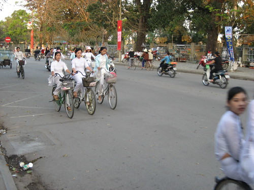
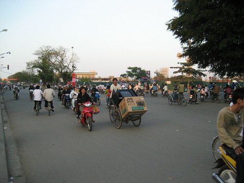
Cau Hai is a rather poor and dusty village that barely stands out from the surrounding areas along the main road Highway 1A. It’s surely totally safe (as is most of Vietnam) to stand there for an hour or so trying to flag a bus back to Hue or south to DeNang (or Hoi An), but it wouldn’t be too pleasant I imagine. We paid a somewhat ridiculous US$90 to be dropped at the park HQ’s in the early morning from Hue and then picked up the next afternoon and taken onto Hoi An. We decided to get a private car at the last minute so we booked through our hotel and didn’t shop around, although the car and driver were fine and on time, and boy was it convenient. They don’t allow scooters, bikes, or motorcycles up the 8-foot wide mountain road, so travelling by one of these modes would only get you to the visitors center below. It was also the beginning of the Tet holiday, which was a reason they cited for the high price. I’ve heard you can get drivers and cars for about $30/day, so this is still an option and will give you much more time to hike and enjoy the park.
JOYS AND PLEASURES: A few of the rangers at the main visitor center speak English quite well and are very enthusiastic about showing you around the visitors center which is set up mostly to educate local school groups. Visit the Five Lakes at different times of the day (early/late) for brilliant light conditions.
ANNOYANCES: The downside of being in the jungle at 1300 meters is that the surroundings are teeming with all sorts of crawling creatures, as we discovered in our room soon enough, much to Cheryl’s dismay. Massive centipedes moving quickly across the floor and live leaches on the bathroom walls were some of the friendly Vietnamese creatures we shared our room with, although this was not a major issue. There we no skeeters to be found and the gentle breeze takes care of the flies, so not a big problem. Some of the trailheads are poorly marked or confusing and there seems to be no good map of the trails. The rangers are eager to help if you ask though.
So that’s my mini guide to the park and I hope it helps a few of you. Vietnam is a wonderful place, but the leisure time for outdoor activities is just developing, so the parks are all a bit rough around the edges, but that is part of what makes a visit to them feel more special. But forget about maps…just forget about it.
-R