Peninsular Malaysia Map
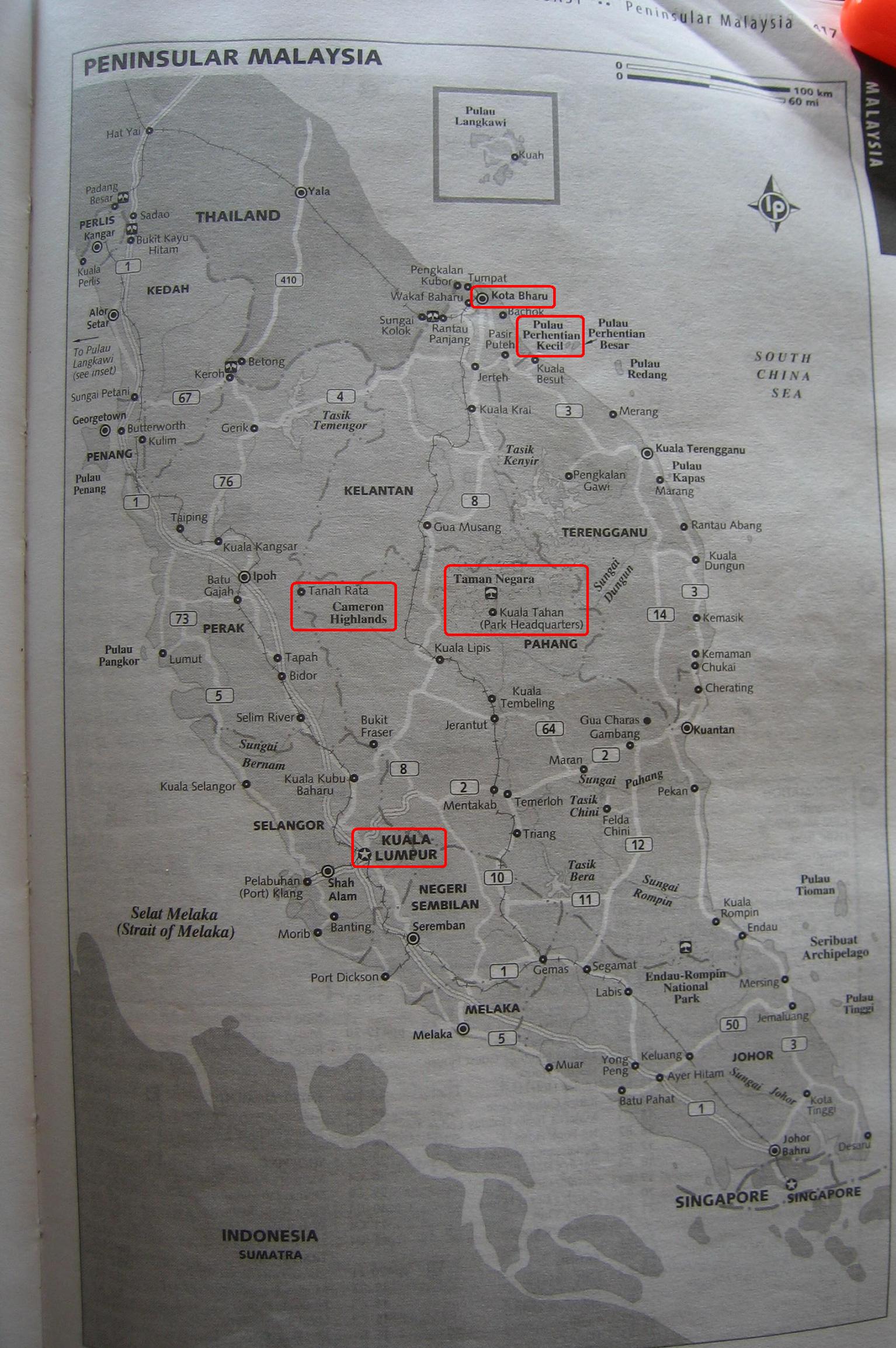
Here’s a fairly high-res map of peninsular Malaysia taken from our guidebook. We added some boxes around the places we’ve been. Be warned that it is about 500kb in size and may take a bit to download. We’ll leave it up until the guidebook threatens to sue us.
We rode a bus from Kuala Lumpur (KL) to Tanah Rata in the Cameron Highlands. A bus and a fast boat from there got us to the island of Pulau Perhentian Kecil. A slow boat and taxi later we were in Kota Baru (aka Kota Bharu according to the map). We rode the Jungle Railway train to get to Jerantut (not marked) were we caught a minivan to Kuala Tahan across the river from Taman Negara National Park. We took a river boat, to a bus to another bus to get back to KL.

Tags: Malaysia

June 16th, 2005 at 7:14 am
Thx fer the map. Oh, by the way, I hear that the Plaa Lard Prik is particularly good at the Thai restaurant in Port Dickson on Selat Melaka. Check it out…
June 16th, 2005 at 5:45 pm
Just once, in one of these remote villages, when you go to the only restaurant in town, try uttering the phrase, a la Chevy Chase in Three Amigos, “So, do you have anything besides Asian food?,” just to see what happens…
Also, Dad, I’m impressed that they have already named a Port after Marcus, his reputation must precede him. 😉
June 18th, 2005 at 5:56 am
Dad – We drove by Port Dickson today, but the bus driver just wouldn’t pull over no matter how good I said the Lard Prik was. Bummer.
Jon – You’d be surprised by how many of these tiny places serve pizza as well. Take my advice and steer clear of green bean pizza though.
June 18th, 2005 at 5:58 am
And as for the Port name bro, NICE, REAL NICE!
I can’t figure out why my friends aren’t commenting on the blog any more…
June 18th, 2005 at 3:58 pm
I’ve had potato pizza w/mashed spuds, does that count! Thanks for giving JT the feedback he is seeking; Marc, your friends are probably afraid of what JT or dad will say next….
Many hugs, xoxoxo