
Days 258-264: Annapurna Circuit Trek, part 3
If it wasn’t for Maoists extortion, this blog entry would be pretty long and boring. After all, it’s pretty hard to follow up a picture of vapor emanating from Marcus’ feet. (We said it was all down hill from the pass.) But we managed to include a few interesting pictures, none the less.
Day 11: Rest day around Muktinath (3,800m or 12,460ft)
Not many body parts that aren’t sore this morning. So we decided we weren’t going to take our bags anywhere and just nose around the pilgrimage sights in the Muktinath area.
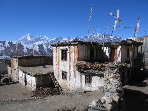
Some neat striped paint jobs on the houses in a nearby town. Nice to see some colors on buildings other than tourist lodges.
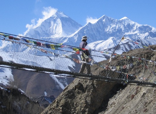
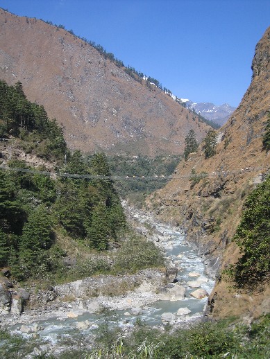
A pleasant stroll amongst the Himalayas. There were a lot of suspension bridges along the hike (Marcus, not terribly fond of heights, did fine).
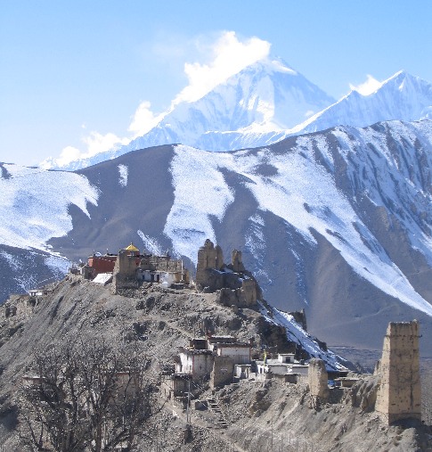
The town of Dzong is named for a large fortress on a thin ridge (‘dzong’ means castle in Tibetan) where the ruler of the valley once lived. Not much of the fort was left, though a monestary has been built on it’s high perch.
Can’t say we enjoyed our time in Dzong. The local adults seemed hell-bent on stoning a dog while we were there. So we got the heck out of there before they decided they didn’t like tourists hanging around either. We have to say that the treatment of animals along the trail was probably the worst we’ve ever seen.
We lost the trail heading back to the Muktinath side of the valley and had to do some serious climbing on our “rest day”. Oops. We also discovered that we had lost the sense of swimming in oxygen we had experienced coming down the hill the previous day and were sucking wind.
After Kelly had yet another cold shower, we discovered something amazing. When you cross the pass the price of dal baht drops as fast as a tired trekker onto a welcoming bed. It had fallen to under $2 and kept falling as we went down. Marcus wants to make a chart of dal baht price versus elevation.
We had played leap frog with a few other trekkers during the course of the hike and we’re keen to see that they all made it over the pass. We ran into the elderly Polish lady doing the trip alone with a porter. When we last saw her, she was falling constantly on the ice coming down the pass. She made it. The young gal with the sprained ankle on Day #1 made it. The one that really impressed us was a 60+ year old German guy who has had two hip replacements going solo. We passed him at a tea house on the way up to the pass and he wasn’t looking too good. He turned up at our hotel the next day along with a huge, brown yak. He ended up sleeping at the tea house and negotiated a yak ride up and over the pass for a mere $80. That’s pretty steep by Nepali standards, but he made it!
Day 12: Muktinath to Jomsom (2,710m or 8,888ft)
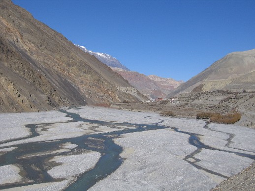
The valley on the way to Kagbeni was pockmarked with sand caves that were so old no body can remember what they were used for.
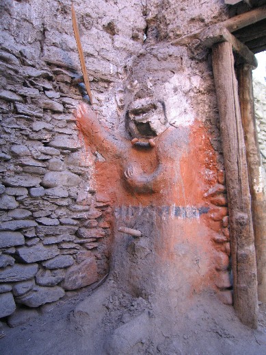
Kagbeni has a crumbling old fort in the middle of town and people have started building their houses right into the walls. The area has male and female protector god statues on opposite sides. We weren’t sure exactly how they protected the place though. We’re guessing the male god statue could take out an eye if you got too close.
Kagbeni’s male protector god is armed and ready for evil doers.
The hike from Kagbeni enters a wide, rocky river valley that generates some remarkable wind and dust storms. Kelly had to go bandito style to protect herself from the sand.
Jomsom is a good-sized village and is the home of a very popular airport. It also had semi-reliable electricity, and we tried to take advantage of the electric heated shower to clean off some filth. Marcus got what he considered the best shower of all time, but then the power went out. Kelly rushed to use the remaining hot water but was yet again denied by the cleaning gods. Perhaps she insulted the protector god in Kagbeni?
Eating by candle light is considered by most to be a romantic affair. We had a nice enough meal and opted for a slice of apple pie. This part of the trail is the apple growing region, and apple pie appears on every menu. So we reasoned that the pie must be pretty good. Unfortunately, it wasn’t very good but we tried to get through it. When the power came on mid-pie, we found it was moldy! Well, it didn’t seem to hurt Rasputin.
Day 13: Jomsom to Kalopani (2,530m or 8,300ft)
Nourished by the mold of last night’s dessert we set off for Kalopani. Fortunately, we found some apple crumble in Tukuche that redeemed the “Apple Pie Trail” moniker. There was not much of a trail down the riverbed, and the many small rivers made for a tricky labyrinth. We decided that the locals would know the way and followed a couple with their horse. It was not long before we realized they didn’t have a clue where they were going, and we ended up having to ford a few streams.
On a random note, we’ve finally got around to reading the Canterbury Tales. Although immensely amusing, it’s very raunchy and we can’t figure out why it is on the reading list for high school. We would have thought the Miller’s tale alone would have it banned from most classrooms.
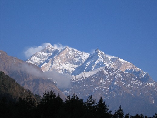
Kalopani had gorgeous views of the Nilgiri mountains.
Day 14: Kalopani to Tatopani (1,190m or 3,900ft)
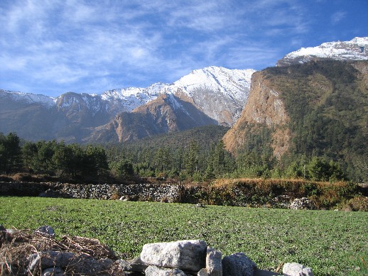
Some nice views of the mountains Annapurna I and Fang along the hike today. Had lunch at Rukse Chahara at the base of a phenomenal waterfall.
The scenery is turning green again.
Some of the suspension bridges can get a bit crowded. All of those white and brown spots are fully-loaded donkeys crossing the bridge.
A miracle occured when we got to Tatopani: Kelly got a hot shower! Her first decent shower since Kathmandu more than two weeks ago. Great food here too! We’re getting horribly spoiled by all the tasty apple treats.
While in town, the Royal Nepalese Army swept through looking for Maoists. Really not sure how you tell a Maoist from a non-Maoist unless they are shooting at you. We’d find out soon enough.
Day 15: Tatopani to Ghorepani (2,750m or 9,020ft)
We had a choice to make: whether to take the quick way out to the road at Beni or keep on hiking to Ghorepani and the panoramic views from Poon Hill and risk the Maoists. Sure it meant climbing an extra 2,000m and risking having our wallets lightened. In the end, we decided our clothes could handle a few more days of stentch and our legs may make the climb.
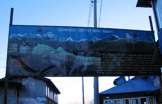
The scenery was really gorgeous when we weren’t looking at the stair steps we were climbing or watching out for Maoists. Our first clue that we were entering Maoist country was the large sign saying: “Welcome to Communist Nepal” signed by the Maoists. We had expected the Maoist encounter to be a few guys with guns jumping out from behind a bush. Marcus tried to “ssshhh” Kelly a few times to not alert the Maoists to our presence. Eventually, we climbed into Ghorepani without running into any Maoists, but were greated with the sign below.
Welcoming sign to Ghorepani: “Communist Party of Nepal (Maoist)” and a long bit about the “The New Nepal”.
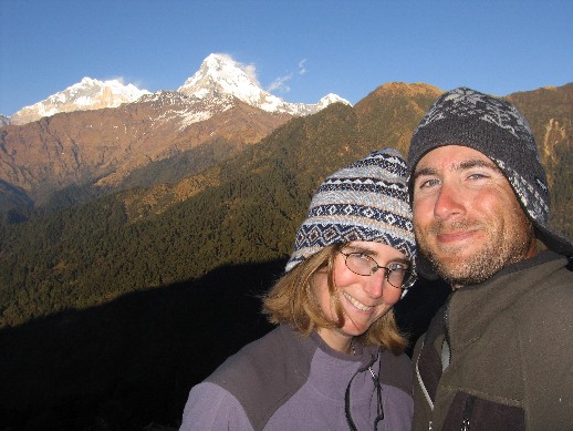
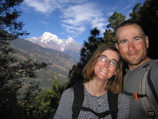
Us and the view from Ghorepani. We think those are Annapurna I and Annapurna South behind us.
That night at dinner, a couple Nepali guys came into the hotel restaurant. One of them went to talk with the dozen or so Nepali guides and porters (they all knew each other), while the other visited us tourists. He was nice enough (looked like Ravinder for those from Caltech), introduced himself as a Maoist and produced a fat receipt book. We didn’t give him a chance to find out how many days we were hiking or what country we were from and just blurted out “How much?”. 1,200Rs each, which was a bit more than $30 for the two of us. He gave us receipts with pictures of Mao, Lenin, and Stalin on them for our “helpfulness donation” and went to the next tourist. No guns (that we saw), no jumping from the bushes, no “How do you think Paul Martin will fare after the corruption scandal implicating Jean Chretien?”, or “Do you think the Maple Leafs will go all the way this year?” At least we didn’t have to carry those heavy rupees up Poon Hill the next morning.
Day 16: Ghorepani to Birethanti (1,025m or 3,360ft)
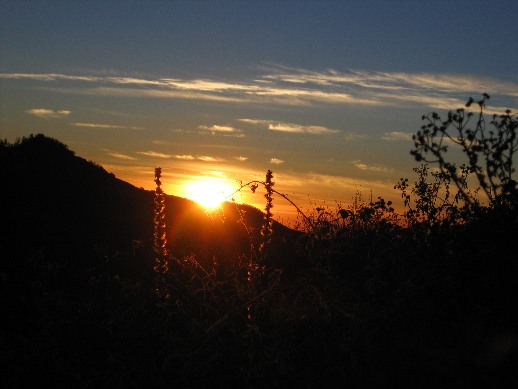
Up early to climb up Poon Hill (3,193m or 10,500 feet) with all the other tourists and watch the sunrise against a Himalayan panorama. Marcus surprised a guy taking a dump in the dark a little too close to the trail who streaked it bare assed to a more suitable location. And we thought it was a New Moon last night. *rim shot!*
The sun makes its debut on a cold Poon Hill morning.
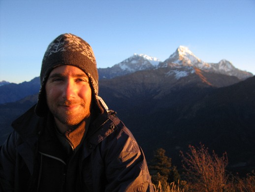
Marcus basking in the warm morning glow. That beard is really starting to come in nicely.
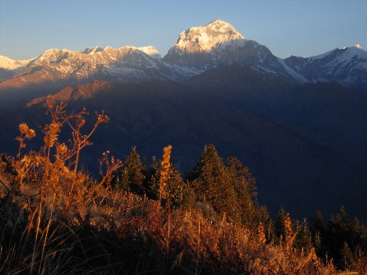
Nice view of Dhaulagiri from Poon Hill.
On the way out of Ghorepani we were greated by a few more Maoists who whipped out their receipt book and asked if we had paid. We showed them the receipts from last night and they bid us good day. All of this was very much out in the open. So we now know how to tell a Maoist: they’re the one’s with the fat receipt books in their pockets.
A cute young Maoist on the way out of Ghorepani.
On the way down the hill from Ghorepani we were passed by about 40 Royal Nepalese Army soldiers with a whole lot of guns headed towards Ghorepani. Where were these guys yesterday? Could have saved us a few bucks in “donation” (or extortion, or “alternative” government tax, or robbery, or bribe, or whatever you want to call it).
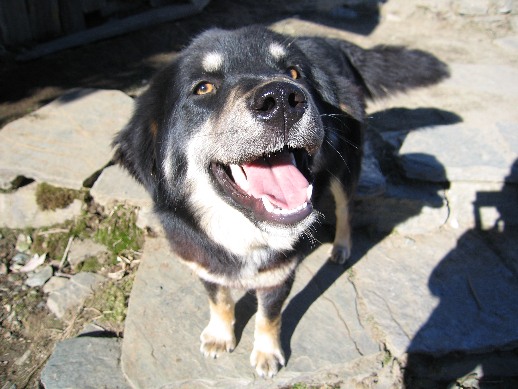
On the way to Birethanti, we inadvertently picked up a travelling companion in the form of a friendly dog. We think he followed us because we were the only ones not beating him or throwing rocks at him – sadly, we’re not exagerating here. He followed us all the way to Birethanti and even helped us check out a few hotel rooms. In fact, this dog was guarding our hotel room when we used the bathroom at 3AM. We would have adopted him if we were in the States.
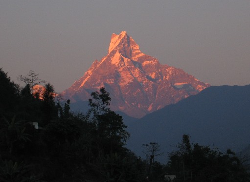
Our riverside hotel had a nice view of Fishtail Mountain. The top does kind of look like a fish’s tail from the right angle.
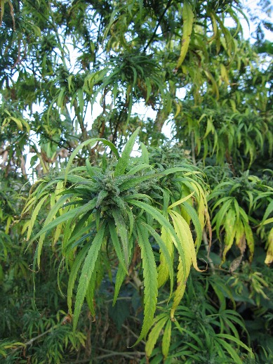
While trying to get better views of Fishtail Mountain, we ran across a strange 10 foot tall herb growing in the hotel garden. Must be why Bob Marley is always playing and the bakeries are so popular.
Had our last dinner of the hike. We discovered something called Tibetan bread that is like a big doughnut that is fantastic. Also discovered that ants float so we could scoup them out of our tea and coffee.
Day 17: Birethanti to Pokhara (820m or 2,690ft)
Again we could have walked to a road in 15 minutes, but we heard about a nice view from the village of Chandrakot (a mere 500m higher at 1,580m). So we went for one last climb. Unfortunately, Chandrakot was so built up that we couldn’t get a clear view of the mountains. We’re glad we snapped this picture on the way up.

Our last picture from the hike. A bit leaner, hairier, and a whole lot dirtier.
The road runs through the town of Lumle and a short walk had us catching a bus to Pokhara. We took the first room we looked at and thought its best feature was the working hot shower. A hang-dog Italian meal, complete with fantastic lattes, really hit the spot. Marcus thought he was looking pretty good in his 18-day beard, but we’re not so sure since every barber we passed yelled out “Shave, sir?”
Tags: Nepal
December 14th, 2005 at 7:38 am
We always liked seeing the pictures of you two included in this blog…until now!
😉
December 14th, 2005 at 9:54 am
This last picture of the two of you would make a great Christmas Card Photo.
– MERRY CHRISTMAS –
Praying for you,
– Bob –
December 15th, 2005 at 5:29 am
Glad you made it safe and sound – the suspension bridges didn’t look like fun – good job Marc!
Yes indeed, we read The Cantubery Tales in HS – Miss Green (Jr year) had lots to say about them too – interesting class!
Hugs xoxox
December 19th, 2005 at 3:31 pm
Hi Kelly & Marcus,
Have a wonderful Christmas, and travel safely.
December 20th, 2005 at 9:37 am
Greetings from Cabo!
Well…how did Poon Hill get its name???!!! You left that part out…
Best,
Poonmaster J
December 22nd, 2005 at 12:20 pm
wow! have a merry christmas…thinking of you both:)
December 27th, 2005 at 2:17 am
marcus,
why didn’t you take your brother along on this trip?
bill
December 27th, 2005 at 4:54 am
Wow, amazing scenery. I’m dying of jealousy. Hey, guess what we found in the south pole galley:
http://images12.fotki.com/v254/photos/6/68399/2928300/DSC_3798-vi.jpg
December 27th, 2005 at 5:07 am
Replies to all comments:
Suzi & Bob – yeah, we thought we were cute if scruffy. 😉
Lynn – you never would have made it across the bridges. They swayed like crazy.
Cozy & Lata – Thanks and you too!
Poonmaster J – I asked myself the same question…
Bill – have you hung out with my brother for more than a few days? 😉
Kiwon – Who stole my cup!? I permit you to use it this summer and recommend filling it with the tasty Aussie port they sell in the store.