Better than a glow-in-the-dark compass ring
Last fall we used a “tourist map” to navigate around Western Australia. It was one of those glossy colorful brochures that only showed a few main roads and was decorated with drawings of the big attractions and local animals. Needless to say when we took a wrong turn, the cartoon picture of kangaroos driving a convertible didn’t help much to get us back on track. By February, we had a thick detailed road atlas that covered every part of New Zealand, even those with very few roads. Finally, we spent the summer in our Peugeot with a built-in GPS and it spoiled us. Every tiny path through fields and villages was in the database, and it never got upset when we took a detour and it had to recalculate. So, it was a big decision in Ireland whether to go back to old fashioned maps or get a GPS. The rental prices are outrageous, and in the end it turned out to be cheaper to buy one since we’ll be able to use it in England, Portugal, and Spain too. We’ve only had it a few days, but I’m already happy with the decision.
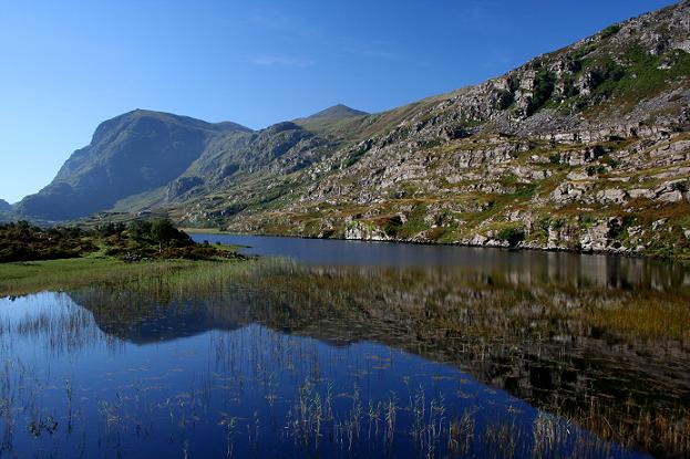
We used the GPS to find our way from Kilkenny to Killarney and great weather followed us. The folks at the B&B called it a “glorious” day, and we thought it was perfect for hiking the Gap of Dunloe. You can decide based on this view: