
Far South
Day 47
It is amazing how much work we create for ourselves. We find ourselves spending time keeping up with accounting, filing and keywording our images, web-site building and upkeep as well as this web log. This does not even consider school work. It seems we are always behind in something. To be fair to ourselves, much of this routine is new to us and we are still finding the most efficient way to get it all done.
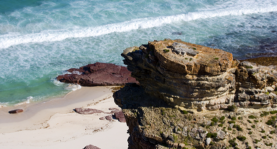
Today we got off to a slow start as we spent some extra time working on the web-site and taking care of accounting. The trip of choice for this afternoon is Cape Point and The Cape of Good Hope. The southern most tip of Africa, as we are taught in school. Don’t believe everything you are taught. Especially when it involves geography and is being taught by an American.
The infamous Cape of Good Hope is actually a few hundred feet shorter than her neighbor Cape Point which is a few hundred yards to the east across a small bay and beach. I know because I stood on the tip with a compass and was livid when I figured out that I had been fooled all these years! Furthermore, Cape Point does not hold the record either, it is actually Cape Argus which is further east from Cape Town and a destination we will visit in two weeks.
At our home in Hout Bay we actually are on the top portion of the Cape Point peninsula. The drive down to the point is not that far. It took a while as the road winds like a spaghetti noodle south. Another stomach masher of a drive for Alexa (we didn’t know she got motion sickness this bad). As we drove south we watched very brave (shark infested waters) surfers catching some breakers coming in from the Atlantic and pulled over to photograph some wild Calla Lilies that grow wild on the side of the road.
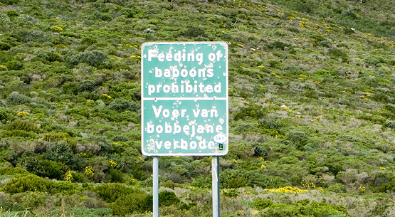
The tip of the Cape is a wild life refuge as well as notable geographic point on the continent. There were lots of sunbirds darting to and fro and reportedly this area is home to numerous baboon, zebra, and other antelope. It is very beautiful and rugged land.
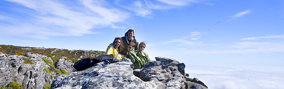
We parked the Opel go-cart and decided to make the forty-five minute hike out to the point itself. The majority of the trail is along a three hundred foot sheer cliff face. There are few if any railings. Awesome. Most of the trail is built on a three-foot wide boardwalk type of walkway and kept very nice. We did not see one rotten board in the entire forty-five minute stretch. We came across a few wild ostrich and sunbirds but no baboons and zebra. Darn.
The view from the point itself is stunning. This is the best type of geography lesson the children could ever learn. I bet when they are sitting in some American classroom one day and the teacher tells them that the Cape of Good Hope is the southern most point, they raise their hand in challenge!
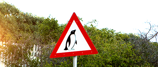
When we headed home, we took a different route which brought us back near Boulders, which is the penguin colony. A place we visited, and wrote about, when we first came to Cape Town. Debbie has decided to take pictures of funny African road signs, so as we passed the penguin crossing she couldn’t resist. With a camera full of images to download, catagorize and take care of and a blog for today to write we complete yet another day of fun and create more work to figure the best way to handle efficiently.
Tags: Hike, South Africa, Travel
Opus wants a penguin crossing sign!
By the way, does anyone know how many calories and what % of fat is in some of these exotic foods? Would any of them be a good replacement meat for cows if mad cow ever breaks out in the USA?
LOVING the photos! Keep ’em coming.
Hugs,
Nana
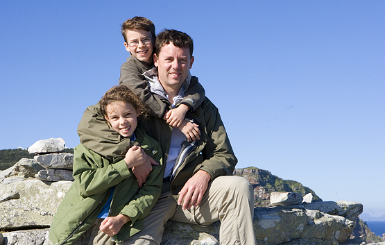
We love the family pic of you at Cape Point…you all look so happy and healthy! Thanks for keeping up on the blog and adding so many fabulous pictures. We are loving it…
Denise, Tom and Maddie